Coastal flooding
After repeated flooding in 2017, residents of a New Orleans neighborhood took matters into their own hands, recording intense rainfall events and subsequent flooding using social media and rain gauges.
The resident-led initiative yielded valuable data, which are now being used for city planning purposes. Real-time data from heat sensors will also help the neighborhood develop new adaptation strategies in the face of more intense heat waves.

Destiney Bell was relaxing in her pajamas at her home in New Orleans when someone knocked on her door.
She almost didn’t open it, not wanting to be bothered. But when Bell peered out the window, she saw a petite, dark-haired woman in plain clothing standing outside, who seemed harmless enough, and decided to open the door. This is how she first met Julia Kumari Drapkin.
Drapkin runs a social media platform called ISeeChange, which mobilizes communities to share stories and collect data about climate change impacts. By bringing community members into the process, the group is able to gather highly localized data, which provide a detailed understanding of the community’s vulnerability to climate change and can be used to inform adaptation efforts. When Drapkin began using her social media platform to ask New Orleans locals about their concerns, it became clear what was on most people’s minds: flooding. Drapkin started recruiting residents to collect data, especially those living in the neighborhood of Gentilly, as it was slated to receive U.S. Department of Housing and Urban Development funding for green infrastructure and was among the areas most affected by the intense rainfall occurring in the city throughout 2017. Locals experienced particularly extreme summer monsoons that year, and with little warning. The city’s pumps weren’t working at full capacity at the time – and even if they had been, it would not have been sufficient to mitigate flooding completely.
Drapkin’s response was incredibly simple, but effective. She talked to local residents about the weather and asked them to record flooding events on the ISeeChange social media platform. Across Gentilly, in nail salons, laundromats and restaurants, she left cards with comment boxes for public feedback and information about ISeeChange.
“People were so fed up with the flooding of 2017, they gave us their names, their phone numbers, emails and they said yes, we will help you do this,” says Drapkin, founder of ISeeChange. “Within two weeks, we had 170 [flooding] hotspots identified.”
“People were so fed up with the flooding of 2017, they gave us their names, their phone numbers, emails and they said yes, we will help you do this. Within two weeks, we had 170 [flooding] hotspots identified.”
Drapkin had partnered with numerous experts to develop rain and flood monitoring techniques that could be used by community members. Experts included meteorologists from the National Weather Service, modelers from the Lower Mississippi River Forecast Center, water architects and green infrastructure engineers, who provided feedback on their methods and data quality. Volunteers from the American Geophysical Union’s Thriving Earth Exchange (TEX) also made site visits to the flooding hotspots to get detailed GPS measurements.
Residents of the waterlogged neighborhood who decided to participate became weather stewards. ISeeChange provided them with rain gauges, and they carefully monitored rainfall and flooding on their block.
Bell says, “The corner that I live on, pretty much every time it rains, floods. Our corner is the worst corner in the neighborhood for some reason.” She describes the water that accumulates there as brown, mucky and filled with trash. Once a dirty diaper even washed up onto her lawn. Although it was a clear and sunny day when Drapkin knocked on Bell’s door, there were still remnants of flooding from rain that fell a couple of days earlier.
After speaking with Drapkin, Bell began uploading images of flooding around her house to the ISeeChange social media platform. “The biggest thing I realized is that it doesn’t really matter how much rain falls – it matters how fast it falls,” says Bell. “If we get half an inch over 30 minutes, my street is going to be flooded. If we get a half an inch over the course of a day, it’s going to be fine.”
By recording her observations, she began to notice another important flooding factor: the amount of time the water lingered in the streets. She began including time stamps on her posts, which led to ISeeChange documenting flood duration in addition to rain intensity.
The rainfall and flooding data collected by Bell and the other residents of Gentilly yielded a highly detailed map of flooding in the neighborhood, which engineers contracted by the city are now incorporating into their plans. The data captures not just flooding location and extent, but social aspects, such as when transportation routes gets disrupted or when playgrounds become too dangerous for children to play in.
In 2018, the international engineering and planning firm, Stantec Consulting Services, Inc., was awarded a contract to improve the quality of life and infrastructure of the Gentilly neighborhood. As the engineers began putting together designs for the City’s Gentilly Resilience District, they reached out to Drapkin. “We saw a lot of value in having her network of people provide us with real-time data regarding flooding, and regarding their concerns,” says Dan Grandal, a vice-president of Stantec. “We’re able to use that data to validate results from our hydraulic models.”
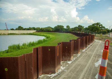
The company is in the process of designing a new green infrastructure project for the neighborhood, called Blue & Green Corridors. The project is supported by $141 million in funding awarded to New Orleans by the U.S. Department of Housing and Urban Development through the National Disaster Resilience Competition. Blue & Green Corridors is currently in the design phase, which will be completed in early 2020, and construction will start shortly thereafter. The project will involve new recreational waterways and green infrastructure, such as landscaped areas and other innovative solutions designed to soak up excess water. Importantly, it will include water storage facilities, which will help mitigate flooding during intense rainfall events and manage stormwater.
Grandal says, “This project provides flood mitigation and neighborhood improvements that will help to bring up the property values and encourage people to develop vacant lots. That fear of flooding, especially in New Orleans, can make a neighborhood undesirable.”
While many neighborhoods in New Orleans have a long history of flooding, the effects are likely to be amplified by climate change. As the Fourth National Climate Assessment notes, “Extreme rainfall events have increased in frequency and intensity in the Southeast, and there is high confidence they will continue to increase in the future. The region, as a whole, has experienced increases in the number of days with more than 3 inches of precipitation and a 16% increase in observed 5-year maximum daily precipitation.”
The report notes that projections under a higher emissions scenario, in which emissions continue to rise throughout the 21st century, show that the number of heavy rainfall events could double in the region by 2100, and the amount of rain falling on the heaviest precipitation days will likely increase by about 20%.
Another major issue facing New Orleans – and all of the Southeastern U.S. – is a higher incidence of heat waves. According to the Fourth National Climate Assessment, “61% of major Southeast cities are exhibiting some aspects of worsening heat waves, which is a higher percentage than any other region of the country. The urban heat island effect (cities that are warmer than surrounding rural areas, especially at night) adds to the impact of heat waves in cities.
“The number of days with high minimum temperatures (nighttime temperatures that stay above 75°F) has been increasing across the Southeast, and this trend is projected to intensify, with some areas experiencing more than 100 additional warm nights per year by the end of the century.”
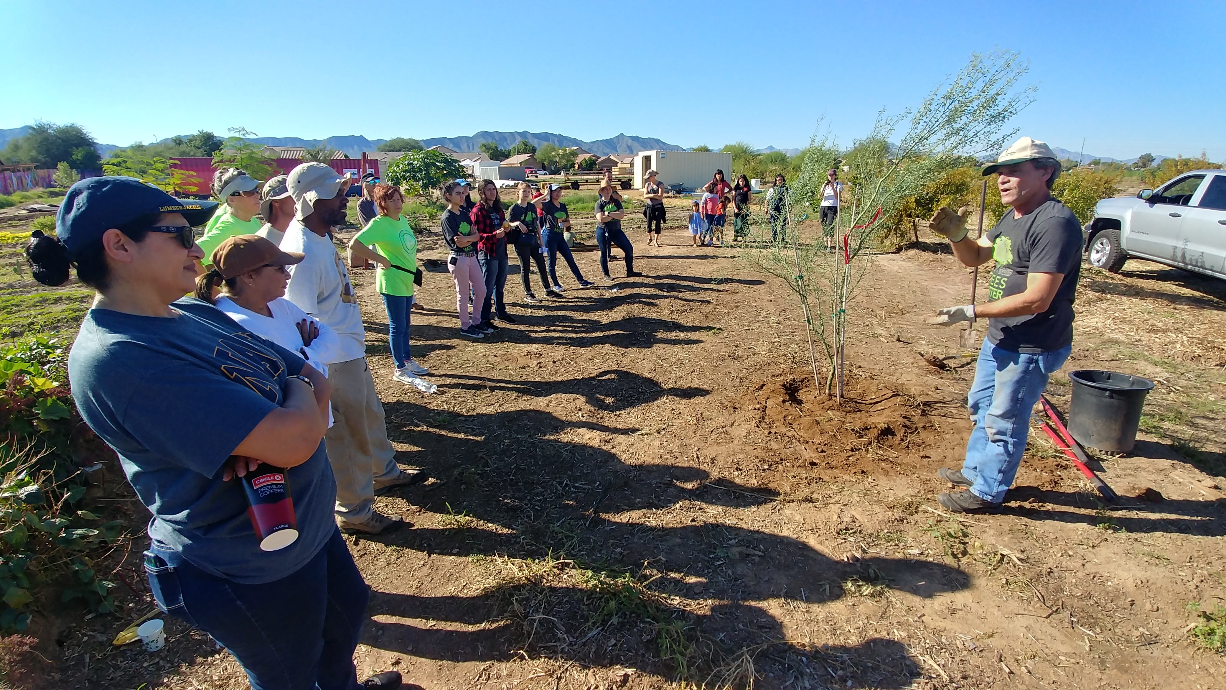
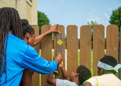
ISeeChange and Stantec are also working to help neighborhoods in New Orleans adjust to these worsening heat waves. Similar to the rain gauge project, ISeeChange began installing heat sensors in New Orleans in April 2019. These sensors help pinpoint areas that are particularly prone to the heat island effect, but also monitor the neighborhood over time, as the Blue & Green Corridors project is implemented and additional green infrastructure is added. The heat sensors – already installed on some utility poles throughout the nearby neighborhood of St. Bernard, will help quantify the impact of planting more trees, for example. The low-cost sensors, designed by a tech company called MCCI, collect and transmit real-time data using low-power radio frequencies. Using the data from these sensors, ISeeChange, with its Thriving Earth Exchange partners at Georgia Tech and MCCI, will be developing a protocol for measuring the impact of green infrastructure. Lastly, the New Orleans Department of Homeland Security, Emergency Preparedness (NOLA Ready) and ISeeChange will be developing a localized heat alert system.
Whether with time-stamped social media posts, rain gauges, or a network of heat sensors, ISeeChange is collecting valuable datapoints over time, creating a detailed picture of weather events as they happen. While recording weather events on social media seems rather novel and modern, the concept is rooted in a much more traditional approach that has helped humans adapt to climate change for more than two centuries: the Old Farmer’s Almanac. This tool – chock-full of valuable environmental data alongside stories over decades – is where Drapkin found her inspiration for ISeeChange.
“The Farmer’s Almanac is the longest running magazine in the United States – and it was an adaptation technique. We need to be able to know where we stand and where we’re going,” she says.
She realized the importance of the Old Farmer’s Almanac when she first launched ISeeChange in a small, conservative town in Colorado. Initially a journalism endeavor, she received funding from the Corporation for Public Broadcasting, and she moved to Paonia, Colorado in 2012 with the aim of engaging the public on climate change.
Some residents of the rural coal-mining town were initially not open to the idea of discussing climate change, and Drapkin received complaints before her project even launched. But gradually, she engaged the public over the radio, asking them to report firsthand what sort of changes they were observing locally.
“Suddenly, we had people telling us about major environmental trends months in advance of mainstream news or government reports,” Drapkin says. Residents reported early spring wildfires in March that year – a whole season before wildfires ravaged the state that summer. They were talking about West Nile virus four months before a nationwide epidemic was announced, according to Drapkin.
“We realized this is people telling us what was happening in real-time, in ways that are so meaningful to the conversation and important for modeling, real-time alerts, and emergency preparedness” she says.
When speaking with local farmers and asking how the environment has changed, some would bring out calendars and journals from decades ago. These old records – in combination with the real-time feedback from locals – prompted Drapkin to create an online Almanac, which has since been adopted by communities across 115 countries.
Drapkin sees the value in collecting real-time data not just for the sake of attaining the data itself, but for equitably engaging communities as well. “Right now, there’s so much on the line when it comes to climate change,” she says. “We need everybody’s talents and perspectives. We need everybody in to co-create solutions.”
Story by: Michelle Hampson (Sept. 2019).
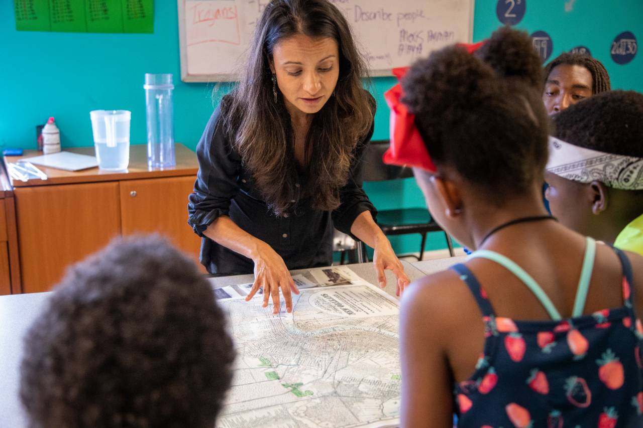
Banner image: Founder of ISeeChange, Julia Kumari Drapkin, shows children a map of historic New Orleans. Credit: Impact Media Lab / AAAS.