Maximizing crop yields under water restrictions
To succeed in the arid plains, farmers in Kansas rely heavily on the Ogallala Aquifer for water to irrigate their crops.
But the reservoir is quickly being depleted, at the same time that drought is becoming a more dire concern in the region because of climate change. To prolong the life of the aquifer, one groundwater management district took a dramatic step, reducing the amount of water farmers can use to irrigate their crops by 20%. After an initial run of five years, the project was proven successful and renewed for another five years, with the support of farmers. To support these water management efforts, researchers are developing models to quantify the exchange of water between crops and the atmosphere – efforts that will become increasingly important as the Southern Great Plains region continues to become drier in the coming years.

The western half of Kansas is a semi-arid landscape, where the atmosphere draws more water from the soil than it gives back in the form of rain. Farmers here know that every drop of water matters if they are going to reap a good crop yield in any given year.
The limited amount of surface water means farmers must draw from the local aquifer. In this region, about 25% of cropland is irrigated, producing about 50% of the region’s crop value. The Ogallala Aquifer has faithfully served farmers in Kansas, as well as seven other states in the western U.S., for many decades – but its water stores have become alarmingly low in recent years. Since 1950, society has depleted the resource by 9% for agricultural irrigation and drinking water purposes, with much bigger declines in parts of Kansas and Texas. Once the reservoir runs dry, it will take 6,000 years for it to recharge, so farmers and nearby residents have to ration what’s left in the reservoir efficiently into the future. To compound this problem, the region is expected to have higher temperatures and increased drought in the coming years, which will force locals to rely on the aquifer even more than they do now.
Realizing the need to conserve this precious water source and extend its lifespan as long as possible, one groundwater management district (GMD), encompassing Colby, Kansas and the surrounding area, decided to make a bold move. In 2012, the GMD proposed reducing the amount of water farmers could use for irrigation by roughly 20% in the Sheridan County part of the district, where groundwater is particularly scarce. The plan meant that farmers in the county would be allocated 55 inches of pumped groundwater over the course of five years, which translates to a roughly 20% reduction from their regular water allocation; farmers could use the water at their discretion and sell the resource to one another, but they would not receive more than their allocated amount. GMD4, the district proposing the reduction, hosted dozens of meetings with local farmers and business owners, who were widely opposed to the plan.
“There were many, many meetings with producers in the area to get their input on how this should be developed,” says Shannon Kenyon, Assistant Manager of GMD4. “It really wasn’t an option of we are or aren’t going to do it, but how are we going to do it.”
“There were many, many meetings with producers in the area to get their input on how this should be developed. It really wasn’t an option of we are or aren’t going to do it, but how are we going to do it.”
Input from farmers was taken into consideration, and then GMD4’s board of directors began putting together a plan for Sheridan County. In 2012, the Sheridan 6 Local Enhanced Management Area (LEMA) statute was passed by the Kansas state government, which would allow GMD4 to implement the reduction in water use for a five-year period beginning in 2013.
“I think that anything like instituting a LEMA is always going to be met with opposition, but it takes leadership, and in our case it came from the board of directors, to say that we have to do something,” Kenyon says. “And a lot of producers that are not part of the opposition, and some that are, admitted we have to do something.”
The project turned out to be a success. Over the course of the five-year period, rainfall was below average in the first two years and above average during the last three – but “even though our goal was 20% savings, we actually ended up saving about 39% of water use over the course of the LEMA,” says Kenyon. An economic analysis shows that farmers in the Sheridan 6 LEMA maintained their profits throughout the course of the five-year period. The sustained profits could in part be due to a shift in crop choice; farmers in the Sheridan 6 LEMA increased their production of sorghum by 335.4% and decreased their production of corn by 23.3%, compared to neighbors outside the LEMA. Soybean producers reported lower crop yield and cash flow, but across the Sheridan 6 LEMA as a whole, farmers reported 4.3% more cash flow than their neighbors.
“It really changed a lot of attitudes” said Kenyon. “Instead of bragging about bushels per acre, farmers were bragging about what their yield was on less water.”
Nearing the end of the first LEMA, the district organized more community meetings with farmers and local stakeholders to discuss details of a second five-year LEMA. “The initial LEMA was met with quite a bit of resistance. But in 2017… the second LEMA was met with no opposition whatsoever,” says Kenyon. “In fact, one gentleman who had testified against the first LEMA pretty vocally showed up for the second five-year public hearing and testified in support of it. It was definitely an eye-opener to a lot of people when they realize, hey, I can do this.”

The mandated reduction in water use in Sheridan 6 was a valuable demonstration that farmers could maintain productivity with less water than what they’ve used in the past. But it also raises the question of how much water is actually necessary. What is the optimal amount to maintain crop yield while maximizing the lifespan of aquifers in these semi-arid regions?
This question will become even more crucial over the next century, as temperatures in the region continue to rise. If no reductions in greenhouse gas emissions take place, the Southern Great Plains is projected to experience an additional 30 to 60 days per year above 100°F by the end of this century. These higher temperatures will not only cause more moisture to evaporate from the soil, making it drier, but will also suck more moisture directly from the plants through a process called evapotranspiration.
The scarcity of water now – and the chance of even less water in the future – is spurring researchers to pinpoint the minimum threshold amounts of water use for crops. Rob Aiken, a crop research scientist at Kansas State University, has been in the field literally and figuratively for about 30 years. In more recent years, Aiken has been working closely with GMD4 to pinpoint that critical threshold for water use.
In 2017, he began working with Ramesh Dhungel, who had recently finished his Ph.D. at the University of Idaho. There, Dhungel created an intricate model that helps capture the evapotranspiration rates of various crops. Weather data – solar radiation, wind speed, air temperature, humidity, and precipitation – and satellite data – the amount of vegetation – are fed into the model. The tool then predicts the fluxes of water occurring between plants and the atmosphere, providing an estimate of the crop’s overall water budget.
“It’s accounting for energy flow from the atmosphere to the surface, looking at radiation, temperature, humidity and landscape, and all of the physics involved in the exchange of energy. It’s also incorporating a model for how vegetative canopy functions in response to those environmental conditions,” explains Aiken.
Using 2013 data from Sheridan 6, Dhungel began simulating the fluxes of water in the region. But he needs to simulate multiple regions and confirm with direct measurements that his model is accurate. So far he has also tested the tool in Idaho and Texas, where devices embedded in the soil helped quantify the model’s accuracy.
“We are trying to quantify the fluxes as accurately as possible, so that we can use every millimeter,” Dhungel says. “Every millimeter of water needs to be utilized in the right way to help mitigate the drought and water scarcity in the western United States.”
In the future, as water becomes scarcer in the Southern Great Plains and other parts of the country, tools like this could help farmers optimize their water usage. “Irrigation is a very critical element of the agricultural economy in western Kansas. Sustaining irrigation is a means of sustaining the rural economy,” Aiken emphasizes. “Geologists at the Kansas Geological Survey (University of Kansas) suggest that this 20% reduction could put the region on the path to sustainable irrigation, sustaining the life blood of its communities.”
Story by: Michelle Hampson.
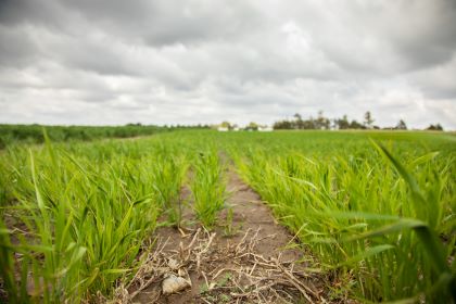
Banner image: Grains of corn produced at the Kansas State University Northwest Research-Extension Center. | Credit: Impact Media Lab / AAAS.